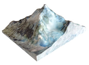
This sheet shows you a "3D JUMBO LAND" item specification in each categories.
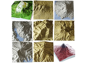
| 3D Data Source | Geospatial Information Authority of Japan (GIAJ) |
| 3D Mesh Distance | 10m |
| 3D Model Coloring |
|
| 2D Image Data Source | using full color map of GIAJ |
| Height expansion | x 1.0 to 2.0
suitable for its height and shape. |
| List of this Category | Refer to GIAJ major mountain information in Japan |
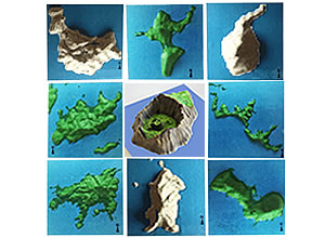
| 3D Data Source | Geospatial Information Authority of Japan (GIAJ) |
| 3D Mesh Distance | 10m |
| 3D Model Coloring |
|
| 2D Image Data Source | using full color map of GIAJ |
| Height expansion | x 1.0 to 1.5
suitable for its height and shape. |
| List of this Category | Islands of Japan which area over 0.5km2 |
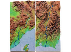
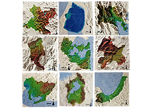
| 3D Data Source | Geospatial Information Authority of Japan (GIAJ) |
||
| 3D Mesh Distance | 10m | ||
| 3D Model Coloring |
|
||
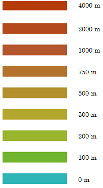
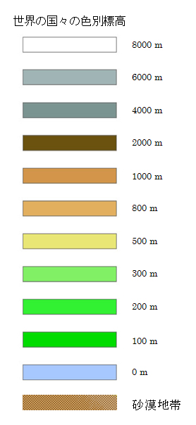
| 2D Image Data Source | * using Full color map of GIAJ * using following color pallet for Full color(gradation by elevation)
|
||
| Height expansion | x 2 to x 5
suitable for its height and shape. |
||
| List of this Category | Listing first class rivers and some famous second class rivers in japan eliminating distributary |
| 3D Data Source | Geospatial Information Authority of Japan (GIAJ) |
||
| 3D Mesh Distance | 10m | ||
| 3D Model Coloring |
|
||
| 2D Image Data Source | using full color map of GIAJ | ||
| Height expansion | x 1.0 to 2.0
suitable for its height and shape. |
||
| List of this Category | All prefecture and also municipal in Japan as of April 2014. |
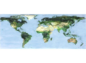
| 3D Data Source | USGS / GTOPO30 | ||
| 3D Mesh Distance | 30 sec(about 1km) | ||
| 3D Model Coloring |
|
||
| 2D Image Data Source | Jumbo's original gradation coloring by elevation | ||
| Height expansion | About 5 to 10 times
suitable for its height and shape. |
||
| List of this Category | Members of United Nations and some of the other country as of Aug. 2015. |
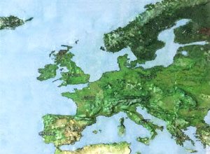
| 3D Data Source | USGS/ASTERGDEM |
| 3D Mesh Distance | 1 arc sec(約0.3km) |
| 3D Model Coloring |
|
| 2D Image Data Source | GoogleMap Satellite image |
| Height expansion | x 1 to 3
suitable for its height and shape. |
| List of this Category | Ref. List of mountains by elevation(en:wikipedia.org) at Dec,2015 |
| 3D Data Source | ISCGM/Global Elevation |
| 3D Mesh Distance | 15 sec( about 0.5km) |
| 3D Model Coloring |
|
| 2D Image Data Source | GoogleMap Satellite image |
| Height expansion | x 5 to 10
suitable for its height and shape. |
| List of this Category | Listing major cities in each country |
← Back to the previous page